
SMART 4D TRAJECTORY
SMART 4D TRAJECTORY
How to automate flight ops of drones and eVTOLs without risking flight safety
How to automate flight ops of drones and eVTOLs without risking flight safety
The Automation Challenge
The Automation Challenge
Unmanned aircraft offer the unique opportunity to automate flight operations at scale. This enables sustainable business cases and applications previously impossible with manned aircraft.
Pilots of drones and air taxis are no longer required to manually execute control inputs to keep the wings level or follow the desired route – also called “pilot in the loop”.
Instead, they select a desired waypoint or maneuver on their ground control station, which is executed automatically.
This type of human interaction is called “pilot on the loop”. It allows pilots to shift their cognitive capacity from basic aircraft flying to flight management and problem-solving.
Aviators are familiar with the 5 P-concept for a long time. Originating from the British Army about a century ago, it stands for “Proper planning prevents poor performance”.
Translated to unmanned aviation, automation must also cover the flight planning process and the related go/no-go decisions to identify unsafe conditions before takeoff.
Complex Operational Environment
Complex Operational Environment
By their very nature, drones and air taxis are sensitive to weather conditions. Wind speed, precipitation, visibility, cloud layers, and icing potential are just a few of the parameters significantly affecting every flight.
When flying close to the ground, terrain and obstacles are a constant threat, and aircraft performance and endurance are limited.
In today’s world of commercial aviation, this type of flight operation is executed only by specialized operators with highly qualified pilots – e.g., emergency medical helicopters or services to offshore oil rigs.
Unmanned aviation thus faces two issues:
1. to operate in these environmental conditions
1. to operate in these environmental conditions
2. to reduce human involvement at the same time without sacrificing flight safety
2. to reduce human involvement at the same time without sacrificing flight safety
Stepping up with technology
Stepping up with technology


The task to replace a pilot with technology can only be solved through data – lots of data.
The Smart 4D Trajectory of Unisphere is the tool to generate this information. For every individual flight, multiple data sources are combined to generate an accurate representation of flight conditions along the full route.
The route itself is represented as four-dimensional in track, vertical profile, and time.
The aircraft is represented with its limitations for airframe and payload but also through a performance model, which can range in complexity from a point mass with characteristic values to the explicit calculation of lift, drag, and propulsion depending on the application.
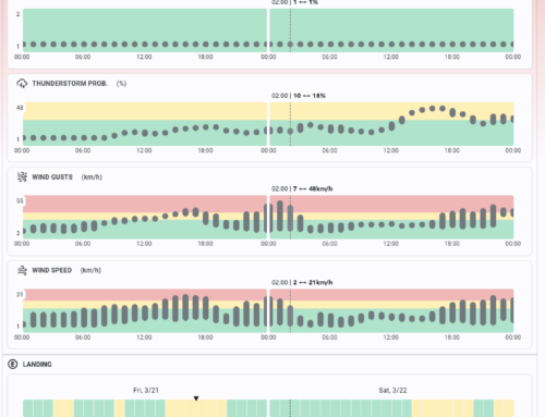
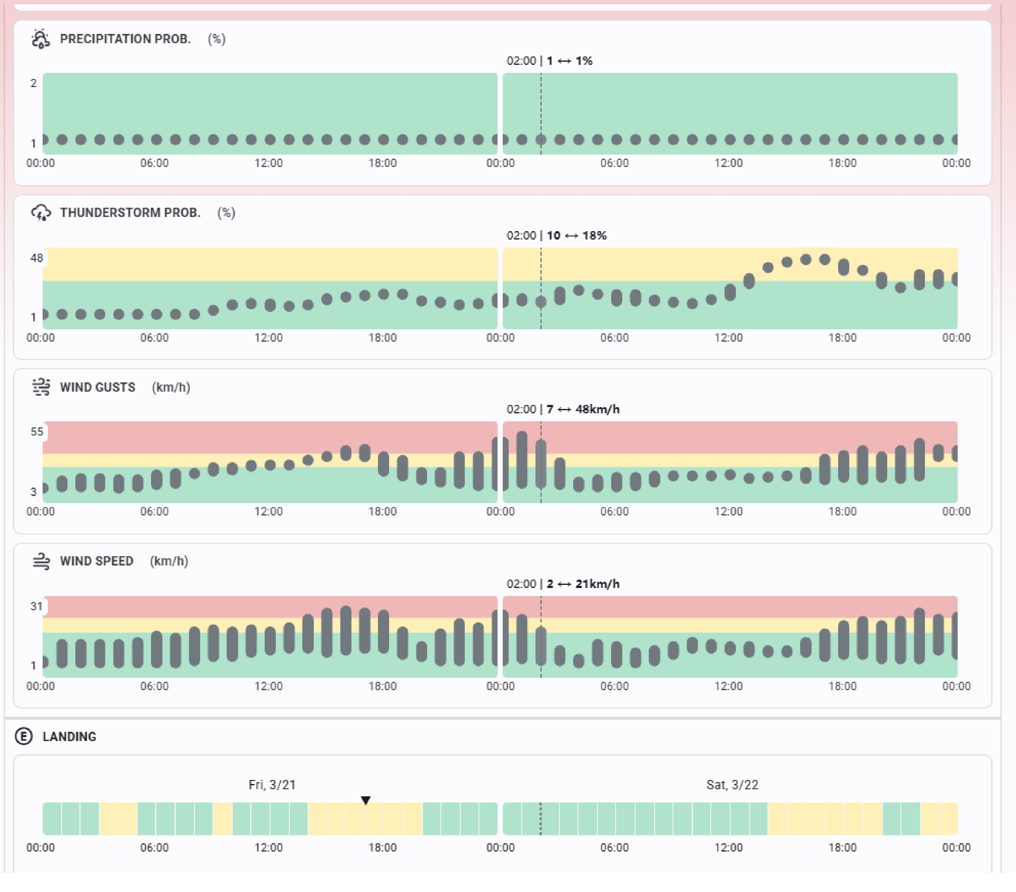
The environmental conditions are modeled using high-resolution weather data. More than 1.000 parameters are available worldwide with an accuracy of down to 90m lateral and 5 min temporal.
The simulation furthermore considers elevation data and aeronautical information.
The combination of these sources creates a data set that accurately represents the conditions the aircraft will experience in flight.
The task to replace a pilot with technology can only be solved through data – lots of data.
The Smart 4D Trajectory of Unisphere is the tool to generate this information. For every individual flight, multiple data sources are combined to generate an accurate representation of flight conditions along the full route.
The route itself is represented as four-dimensional in track, vertical profile, and time.
The aircraft is represented with its limitations for airframe and payload but also through a performance model, which can range in complexity from a point mass with characteristic values to the explicit calculation of lift, drag, and propulsion depending on the application.
The environmental conditions are modeled using high-resolution weather data. More than 1.000 parameters are available worldwide with an accuracy of down to 90m lateral and 5 min temporal.
The simulation furthermore considers elevation data and aeronautical information.
The combination of these sources creates a data set that accurately represents the conditions the aircraft will experience in flight.
Algorithmic Evaluation and Cloud-Scale Simulations
Algorithmic Evaluation and Cloud-Scale Simulations
The Unisphere Smart 4D Trajectory includes pilot know-how transferred into automated evaluation algorithms.
In the second step, the data is scanned to generate information on the feasibility and risk of a flight.
Using the computation power of the cloud, Unisphere currently simulates and evaluates about 30.000 trajectories per day with the ability to scale.
Next, an interface to U-Space Service providers is planned to integrate real-time air traffic data, enabling instant in-flight replanning.
NOVA: Transforming Aviation Expertise into Enterprise Software
NOVA: Transforming Aviation Expertise into Enterprise Software
Unisphere’s NOVA Operations Platform is commercial aviation know-how transferred into software. The integrated Smart 4D Trajectory is a key technology to automate the operation of BVLOS drones and eVTOLs, reducing the human interaction for every individual flight.
Unisphere’s NOVA Operations Platform is commercial aviation know-how transferred into software.
The integrated Smart 4D Trajectory is a key technology to automate the operation of BVLOS drones and eVTOLs, reducing the human interaction for every individual flight.


